


Curiosity Blog, Sols 4879-4885: Struggle at Atacama
Written by William Farrand, Senior Research Scientist, Space Science Institute Earth planning date: Friday, May 1, 2026 Chile’s Atacama desert is the driest mid-latitude desert in the world, receiving only 15 millimeters (0.59 inches) of precipitation per year. Only the dry valleys of Antarctica receive less precipitation. These environmental conditions have made the Atacama a […]
3 min read
Curiosity Blog, Sols 4879-4885: Struggle at Atacama

Written by William Farrand, Senior Research Scientist, Space Science Institute
Earth planning date: Friday, May 1, 2026
Chile’s Atacama desert is the driest mid-latitude desert in the world, receiving only 15 millimeters (0.59 inches) of precipitation per year. Only the dry valleys of Antarctica receive less precipitation. These environmental conditions have made the Atacama a challenging place to survive in. Like its namesake, the Atacama drill target on Mars presented a challenge to the Curiosity rover and to the rover team.
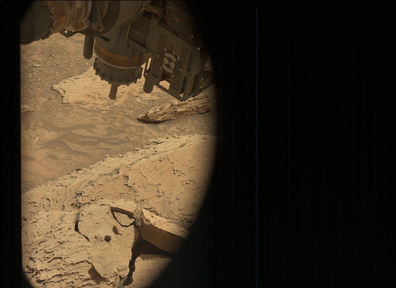
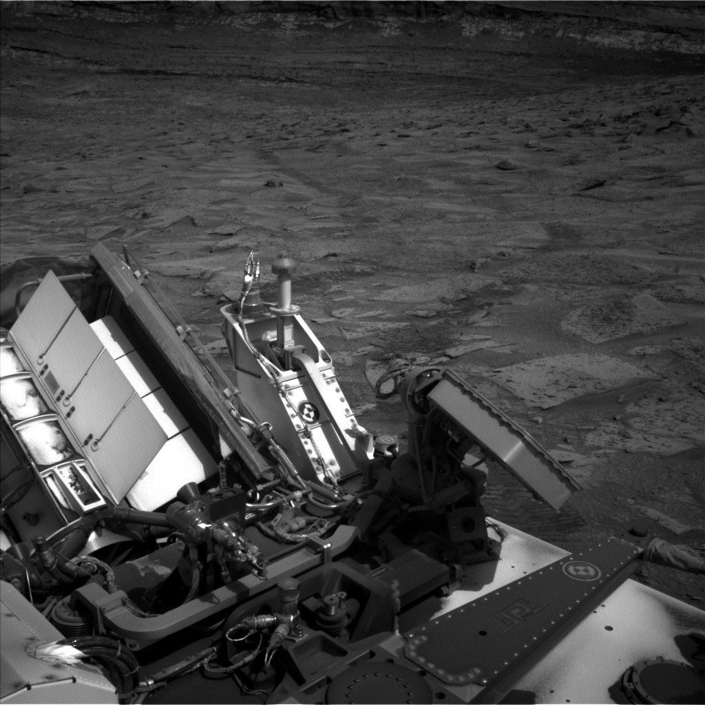
The planning week began with the downlinked data indicating that a successful drill hole was made in the Atacama target, but the rock being drilled into was a detached block and as the arm was raised to extract the drill, the rock came along with it! Not being in the sample collection business, like her twin rover Perseverance, Curiosity’s rover planners went to work to develop a plan to extract the drill bit from the rock. These included efforts at changing the orientation of the drill bit, and attached block, as well as carrying out percussion to try to vibrate the rock off. Ultimately, as a result of activities like these in the Sol 4883-4885 plan, we freed the drill from the Atacama block.
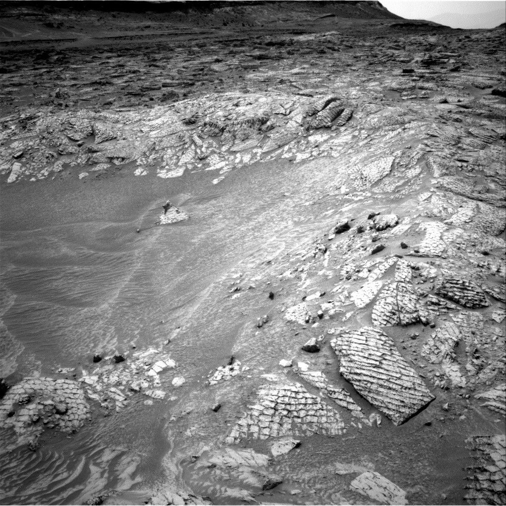
With in-situ science activities precluded due to the efforts to free the drill bit from the Atacama block, the science at that time instead focused on remote sensing. The Sol 4879-4880 plan included ChemCam LIBS measurements of a dark cobble, “Pichiacani,” and a dark pebble, “Poco a Poco.” ChemCam also attempted passive reflectance measurements of white blocks on the slope of the distant Paniri butte and RMI imaging of Valle Grande. Mastcam collected documentation images of the ChemCam targets and also carried out change detection imaging of the target “Playa los Metales.”
The Sol 4881-4882 plan consisted of LIBS scanning of bedrock targets “El Plomo” and “El Turbio.” Mastcam change detection on the Playa los Metales regions continued. Mastcam also extended the previously collected “Kimsa Chata” mosaic. In the Sol 4883-4885 plan, the team was able to take advantage of the efforts to remove the Atacama block by carrying out ChemCam LIBS observations of the granular material below where the block had been. This included the target “Cuturipa,” below where the block had been, and a profile of the wall of the cavity where the block had been, which was given the target name “Chaitén.” ChemCam also observed a light-toned block, “Chiloé,” that had been covered by the Atacama block. ChemCam RMI imaging was planned for the layering of the Mishe Mokwa butte and of “Azul Pampa,” a rock with prominent polygonal patterns. The plan also included a Navcam dust-devil survey, ChemCam passive-sky measurements, and an APXS atmospheric observation.
Future activities involve wrapping up the drill campaign on Atacama and, nominally, seeking a more firmly rooted drill target in order to collect drill tailings for analysis, which were lost from Atacama as part of the effort to dislodge the drill bit from the rock.

Share
Details
Related Terms
Explore More


What's Your Reaction?