NASA “Wildfire Digital Twin” Pioneers New AI Models and Streaming Data Techniques for Forecasting Fire and Smoke
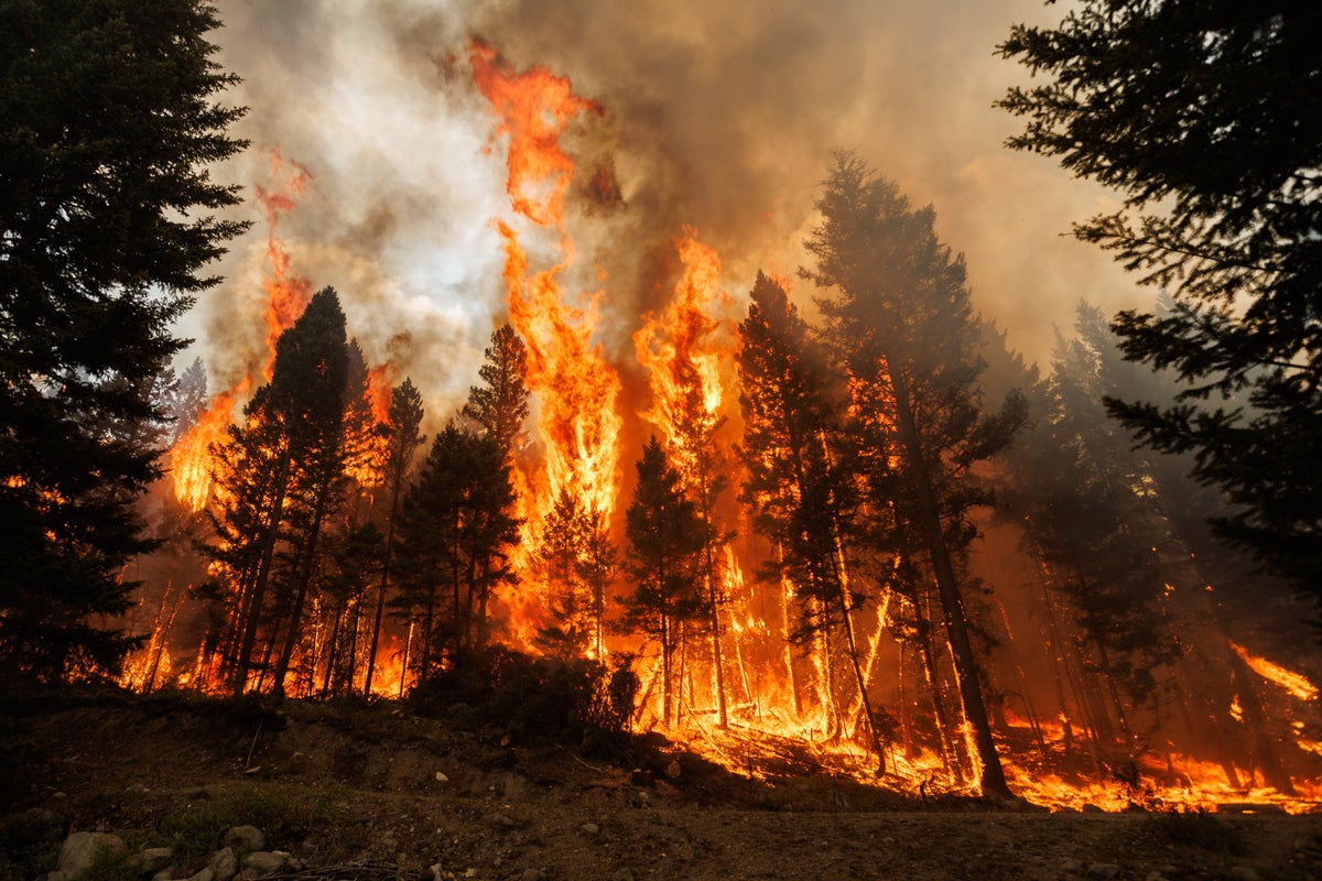
NASA’s “Wildfire Digital Twin” project will equip firefighters and wildfire managers with a superior tool for monitoring wildfires and predicting harmful air pollution events and help researchers observe global wildfire trends more precisely.

5 min read
NASA “Wildfire Digital Twin” Pioneers New AI Models and Streaming Data Techniques for Forecasting Fire and Smoke
NASA’s “Wildfire Digital Twin” project will equip firefighters and wildfire managers with a superior tool for monitoring wildfires and predicting harmful air pollution events and help researchers observe global wildfire trends more precisely.
The tool, developed with funding from NASA’s Earth Science Technology Office and NASA’s FireSense Program, will use artificial intelligence and machine learning to forecast potential burn paths in real time, merging data from in situ, airborne, and spaceborne sensors to produce global models with high precision.
Whereas current global models describing the spread of wildfires and smoke have a spatial resolution of about 10 kilometers per pixel, the Wildfire Digital Twin would produce regional ensemble models with a spatial resolution of 10-to-30 meters per pixel, an improvement of two orders of magnitude.
These models could be generated in a span of mere minutes. By comparison, current global models can take hours to produce.
Models with such high spatial resolution produced at this speed would be immensely valuable to first-responders and wildfire managers trying to observe and contain dynamic burns.
Milton Halem, a Professor of Computer Science and Electrical Engineering at the University of Maryland, Baltimore County, leads the Wildfire Digital Twin project, which includes a team of more than 20 researchers from six universities.
“We want to be able to provide firefighters with useful, timely information,” said Halem, adding that in the field, “there is generally no internet, and no access to big supercomputers, but with our API version of the model, they could run the digital twin not just on a laptop, but even a tablet,” he said.
NASA’s FireSense project is focused on leveraging the agency’s unique Earth science and technological capabilities to achieve improved wildfire management across the United States.
NASA’s Earth Science Technology Office supports this effort with its newest program element, Technology Development for support of Wildfire Science, Management, and Disaster Mitigation (FireSense Technology), which is dedicated to developing novel observation capabilities for predicting and managing wildfires –including technologies like Earth System Digital Twins.
Earth System Digital Twins are dynamic software tools for modeling and forecasting climate events in real time. These tools rely on data sources distributed across multiple domains to create ensemble predictions describing everything from floods to severe weather.
In addition to assisting first responders, an Earth System Digital Twin dedicated to modeling wildfires would also be valuable to scientists monitoring wildfire trends globally. In particular, Halem hopes Wildfire Digital Twins will improve our ability to study wildfires across global boreal forests of cold-hardy conifers, which sequester vast amounts of carbon.
When these forests burn, all of that carbon is released back into the atmosphere. One study, released in August of 2023, found that boreal wildfires alone accounted for 25% of all global CO2 emissions for that year to date.
“The reason CO2 emissions from Boreal wildfires are taking place at an increasing yearly rate is because global warming is rising faster at high latitudes than the rest of the planet, and as a result, boreal summers there are becoming longer,” said Halem. “Whereas the rest of the planet may have warmed one degree Celsius since the pre-industrial revolution, this region has warmed well over two degrees.”
Halem’s work builds on other wildfire models, particularly the NASA-Unified Weather Research and Forecasting (NUWRF) model, developed by NASA, and WRF-SFIRE, developed by a team of researchers with support from the National Science Foundation. These models simulate phenomena like wind speed and cloud cover, which makes them the perfect foundation for a Wildfire Digital Twin.
Specifically, Halem’s team is working on new satellite data assimilation techniques that will blend information from space-based remote sensors into their Wildfire Digital Twin, enabling improved global data forecasts that will be useful for emergencies and science missions alike.
In October, Halem’s team participated in the first FireSense field campaign in collaboration with the National Forest Service’s Fire and Smoke Model Evaluation Experiment (FASMEE) to observe smoke as it traveled more than 10 miles during a controlled burn in Utah, using a ceilometer. Now the team is feeding that data into their modeling software to help it track plumes more accurately.
They’re especially interested in tracking particles smaller than 2.5 micrometers, which are small enough to pass through a person’s lungs and enter the bloodstream. These particles, also known as PM 2.5, can cause serious health issues even if a person is nowhere near an active burn.
“When these fires ignite and start to burn, they produce smoke, and this smoke travels considerable distances. It affects people not only locally, but also at distances of thousands of kilometers or more,” said Halem.
Data from the controlled burn will also help Halem and his team quantify the relationship between aerosols and precipitation. Increased aerosols from wildfires have a huge impact on cloud formation, which in turn impacts how precipitation occurs downstream of an affected fire burn.
Assimilating all this information as it streams from sensors in real time is essential for detailing the full impact of wildfires at local, regional, and global scales.
PROJECT LEAD
Milton Halem, University of Maryland at Baltimore County
SPONSORING ORGANIZATION
NASA’s FireSense Technology Program, a part of the agency’s Earth Science Technology Office (ESTO), funds this project.
Share
Details
Related Terms
What's Your Reaction?


