New NASA Software Simulates Science Missions for Observing Terrestrial Freshwater
From radar instruments smaller than a shoebox to radiometers the size of a milk carton, there are more tools available to scientists today for observing complex Earth systems than ever before. But this abundance of available sensors creates its own unique challenge: how can researchers organize these diverse instruments in the most efficient way for […]
4 min read
New NASA Software Simulates Science Missions for Observing Terrestrial Freshwater
From radar instruments smaller than a shoebox to radiometers the size of a milk carton, there are more tools available to scientists today for observing complex Earth systems than ever before. But this abundance of available sensors creates its own unique challenge: how can researchers organize these diverse instruments in the most efficient way for field campaigns and science missions?
To help researchers maximize the value of science missions, Bart Forman, an Associate Professor in Civil and Environmental Engineering at the University of Maryland, and a team of researchers from the Stevens Institute of Technology and NASA’s Goddard Space Flight Center, prototyped an Observational System Simulation Experiment (OSSE) for designing science missions dedicated to monitoring terrestrial freshwater storage.
“You have different sensor types. You have radars, you have radiometers, you have lidars – each is measuring different components of the electromagnetic spectrum,” said Bart Forman, an Associate Professor in Civil and Environmental Engineering at the University of Maryland. “Different observations have different strengths.”
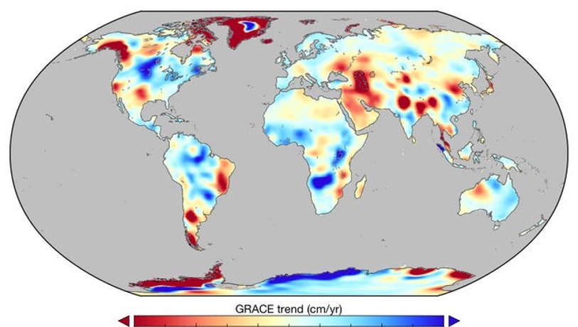
Terrestrial freshwater storage describes the integrated sum of freshwater spread across Earth’s snow, soil moisture, vegetation canopy, surface water impoundments, and groundwater. It’s a dynamic system, one that defies traditional, static systems of scientific observation.
Forman’s project builds on prior technology advancements he achieved during an earlier Earth Science Technology Office (ESTO) project, in which he developed an observation system simulation experiment for mapping terrestrial snow.
It also relies heavily on innovations pioneered by NASA’s Land Information System (LIS) and NASA’s Trade-space Analysis Tool for Designing Constellations (TAT-C), two modeling tools that began as ESTO investments and quickly became staples within the Earth science community.
Forman’s tool incorporates these modeling programs into a new system that provides researchers with a customizable platform for planning dynamic observation missions that include a diverse collection of spaceborne data sets.
In addition, Forman’s tool also includes a “dollars-to-science” cost estimate tool that allows researchers to assess the financial risks associated with a proposed mission.
Together, all of these features provide scientists with the ability to link observations, data assimilation, uncertainty estimation, and physical models within a single, integrated framework.
“We were taking a land surface model and trying to merge it with different space-based measurements of snow, soil moisture, and groundwater to see if there was an optimal combination to give us the most bang for our scientific buck,” explained Forman.
While Forman’s tool isn’t the first information system dedicated to science mission design, it does include a number of novel features. In particular, its ability to integrate observations from spaceborne passive optical radiometers, passive microwave radiometers, and radar sources marks a significant technology advancement.
Forman explained that while these indirect observations of freshwater include valuable information for quantifying freshwater, they also each contain their own unique error characteristics that must be carefully integrated with a land surface model in order to provide estimates of geophysical variables that scientists care most about.
Forman’s software also combines LIS and TAT-C within a single software framework, extending the capabilities of both systems to create superior descriptions of global terrestrial hydrology.
Indeed, Forman stressed the importance of having a large, diverse team that features experts from across the Earth science and modeling communities.
“It’s nice to be part of a big team because these are big problems, and I don’t know the answers myself. I need to find a lot of people that know a lot more than I do and get them to sort of jump in and roll their sleeves up and help us. And they did,” said Forman.
Having created an observation system simulation experiment capable of incorporating dynamic, space-based observations into mission planning models, Forman and his team hope that future researchers will build on their work to create an even better mission modeling program.
For example, while Forman and his team focused on generating mission plans for existing sensors, an expanded version of their software could help researchers determine how they might use future sensors to gather new data.
“With the kinds of things that TAT-C can do, we can create hypothetical sensors. What if we double the swath width? If it could see twice as much space, does that give us more information? Simultaneously, we can ask questions about the impact of different error characteristics for each of these hypothetical sensors and explore the corresponding tradeoff.” said Forman.
PROJECT LEAD
Barton Forman, University of Maryland, Baltimore County
SPONSORING ORGANIZATION
NASA’s Advanced Information Systems Technology (AIST) program, a part of NASA’s Earth Science Technology Office (ESTO), funded this project
Share
Details
Related Terms
What's Your Reaction?


