


Sea Ice Swirls
NASA’s Terra satellite captured floating fragments of sea ice as ocean currents carried them south along Greenland’s east coast on June 4, 2024. This ice traveled from the Fram Strait, a 450-kilometer (280-mile)-wide passage between Greenland and Svalbard, to the Arctic Ocean. Along the journey, it breaks into smaller pieces and starts to melt in […]
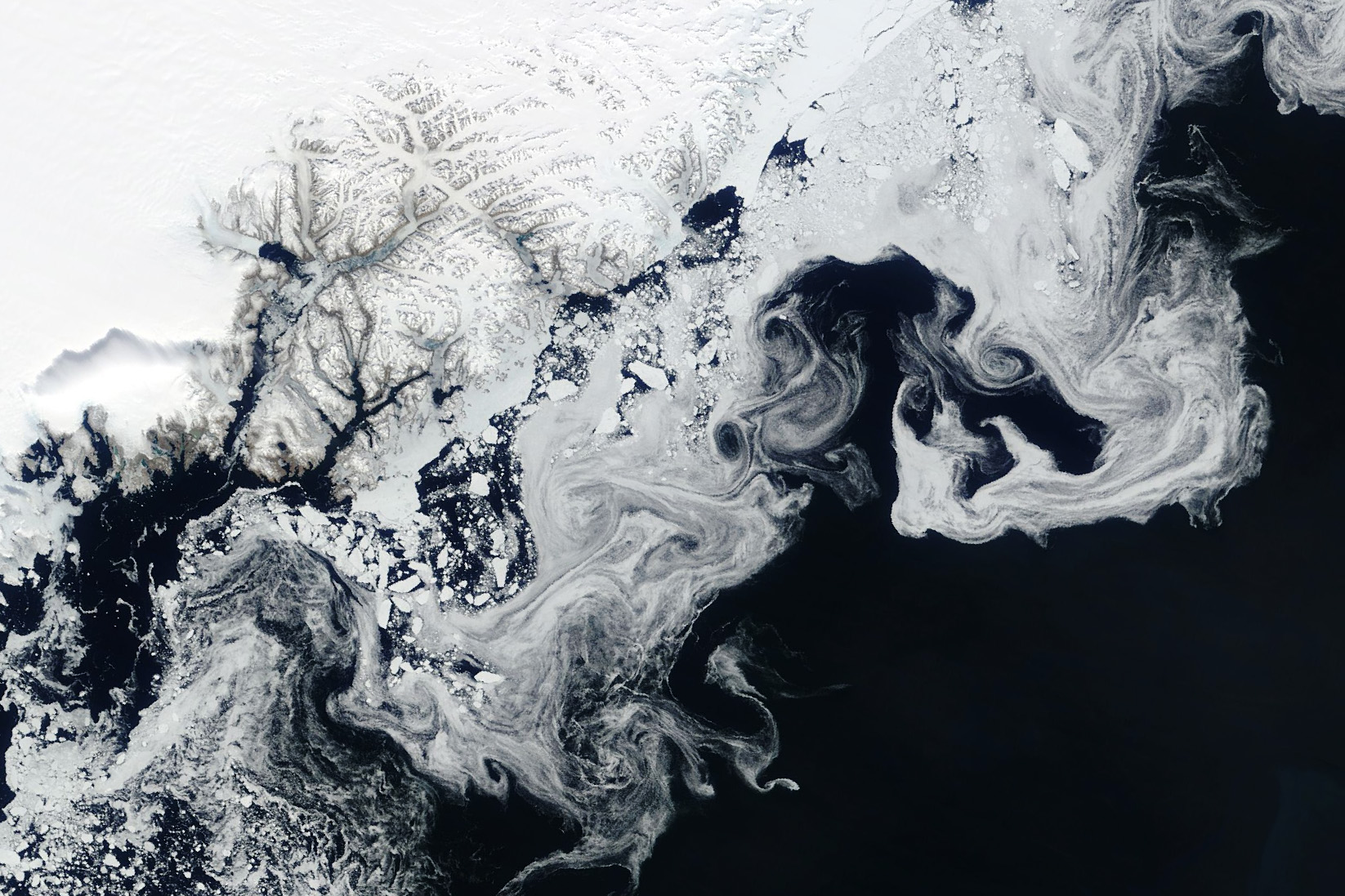
NASA’s Terra satellite captured floating fragments of sea ice as ocean currents carried them south along Greenland’s east coast on June 4, 2024.
This ice traveled from the Fram Strait, a 450-kilometer (280-mile)-wide passage between Greenland and Svalbard, to the Arctic Ocean. Along the journey, it breaks into smaller pieces and starts to melt in warmer ocean waters, creating the wispy patterns seen here.
Learn more about Arctic sea ice.
Image Credit: NASA/Wanmei Liang, using MODIS data from NASA EOSDIS LANCE and GIBS/Worldview
What's Your Reaction?