


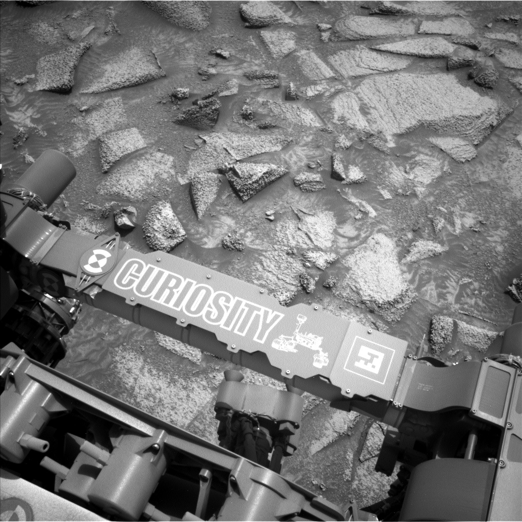
Sols 4325-4326: (Not Quite) Dipping Our Toes in the Sand
Earth planning date: Friday, Oct. 4, 2024 If you read this blog very often, you know that nearly every time the rover stops for science, MAHLI and APXS focus on interesting (and accessible!) rocks as targets. The rover science team is, after all, built with a lot of geologists. But geology is not all rocks, […]
3 min read
Sols 4325-4326: (Not Quite) Dipping Our Toes in the Sand

Earth planning date: Friday, Oct. 4, 2024
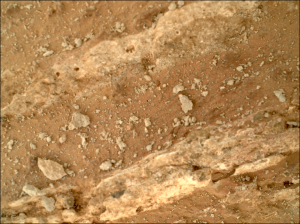
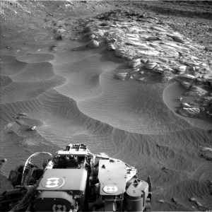
If you read this blog very often, you know that nearly every time the rover stops for science, MAHLI and APXS focus on interesting (and accessible!) rocks as targets. The rover science team is, after all, built with a lot of geologists. But geology is not all rocks, all the time — sand is former rock that if buried and pressurized long enough will become rock again. Today was time for sand to shine, as the workspace was cut by troughs of sand of different colors and brightnesses, and it had been nearly 500 sols since we acquired our last dedicated sand measurement with APXS and MAHLI. The “Pumice Flat” target was one of the brighter sand patches while “Kidney Lake” was one of the darker sand patches. APXS uses a special placement mode over sand targets so the instrument gets close, but not too close, to the loose material which could foul up the instrument. Not-rock was also the purview of our environmental observations. Navcam is scheduled for imaging seeking out clouds and dust devils, and changes in the sand and dust on top of the rover deck. Both Navcam and Mastcam will make observations to measure the amount of dust in the atmosphere. REMS will keep track of our weather with regular measurements, RAD will monitor our radiation environment, and DAN will look through rock for signs of water beneath our drive path.
Unsurprisingly, the rest of the rover could not ignore bedrock. We managed to squeeze in DRT cleaning of a nice bedrock slab, “Ribbon Fall,” for MAHLI-only imaging. In places, the bedrock slabs were cut by thin veins of darker gray material, similar to dark gray materials we saw in the bedrock on the other side of Gediz Vallis. ChemCam targeted one of these dark gray examples at “Black Divide,” and also rastered across some of the prominent layers visible in the vertical faces in the workspace at the aptly named “Profile View.”
Our imaging efforts could be roughly divided between looking back at our path through Gediz Vallis from our new and higher perspective, and looking ahead to what awaits us. ChemCam planned RMI mosaics back toward a field of the white stones we spent time studying in Gediz Vallis and toward a part of the edge of Gediz Vallis that we did not explore previously. Mastcam looked back at the part of the edge of Gediz Vallis we just traversed, “Pilot Peak,” for clues as to why it sits higher than the bedrock farther from the channel edge. They also targeted “Clyde Spires,” which was a gravel ridge in Gediz Vallis of interest as we drove by it initially. Looking ahead, Mastcam imaged a puzzling gray rock sitting atop the bedrock slabs south of us at target “Buena Vista Grove,” and further south still, they planned a large mosaic covering a very big rock — the spectacular “Texoli” butte that has loomed and will continue to loom over our path for months to come.
Written by Michelle Minitti, Planetary Geologist at Framework
Share
Details
Related Terms
Explore More


What's Your Reaction?