Sols 4454-4457: Getting Ready to Fill the Long Weekend with Science
Earth planning date: Friday, Feb. 14, 2025 Curiosity is continuing to make progress along the strategic route, traversing laterally across the sulfate (salt) bearing unit toward the boxwork structures. The team celebrated the completion of another successful drive when we received the downlink this morning, and then we immediately got to work thinking about what’s […]

2 min read
Sols 4454-4457: Getting Ready to Fill the Long Weekend with Science

Earth planning date: Friday, Feb. 14, 2025
Curiosity is continuing to make progress along the strategic route, traversing laterally across the sulfate (salt) bearing unit toward the boxwork structures. The team celebrated the completion of another successful drive when we received the downlink this morning, and then we immediately got to work thinking about what’s next. There is a holiday in the United States on Monday, so instead of the typical three-sol weekend plan, we actually planned four sols, which will set us up to return to planning next Tuesday.
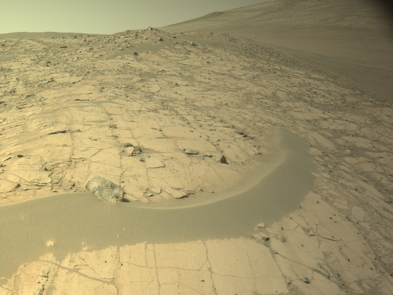
The first sol of the plan focuses on remote sensing, and we’ll be taking several small Mastcam mosaics of features around the rover. One of my favorite targets the team picked is a delightfully pointy rock visible toward the left of the Navcam image shown above. The color images we’ll take with Mastcam will give us more information about the textures of this rock and potentially provide insight into the geologic forces that transformed it into this comical shape. The team chose what I think is a very appropriate name for this Martian pyramid-shaped target — “Pyramid Lake.” The terrestrial inspiration behind this name is a human-made reservoir (lake) near Los Angeles with a big (also human-made) pyramidal hill in it.
On the second sol of the plan, we’ll use the instruments on Curiosity’s arm to collect data of rock targets at our feet, including “Strawberry Peak,” a bumpy piece of bedrock, “Lake Arrowhead,” a smooth piece of bedrock, and “Skyline Trail,” a dark float rock. ChemCam will also collect chemical data of Skyline Trail, “Big Tujunga” — which is similar to Strawberry Peak — and “Momyer.” We’ll also take the first part of a 360-degree color mosaic with Mastcam!
In the third sol of the plan, we’ll complete the 360-degree mosaic and continue driving to the southwest along our strategic route. The fourth sol is pretty quiet, with some atmospheric observations and a ChemCam AEGIS. Atmospheric observations are additionally sprinkled throughout other sols of the plan. This time of year we are particularly interested in studying the clouds above Gale crater!
I’m looking forward to the nice long weekend, and returning on Tuesday morning to see everything Curiosity accomplished.
Written by Abigail Fraeman, Planetary Geologist at NASA’s Jet Propulsion Laboratory
Share
Details
Related Terms
What's Your Reaction?


