


Sols 4500-4501: Bedrock With a Side of Sand
Written by Sharon Wilson Purdy, Planetary Geologist at Smithsonian National Air and Space Museum Earth planning date: Wednesday, April 2, 2025 Wow, sol 4500. What an impressive number of sols (Martian days) exploring the Red Planet! This delightfully even sol number made me wonder where the Mars Exploration Rover (MER) Opportunity was at this point […]

3 min read
Sols 4500-4501: Bedrock With a Side of Sand
Written by Sharon Wilson Purdy, Planetary Geologist at Smithsonian National Air and Space Museum
Earth planning date: Wednesday, April 2, 2025
Wow, sol 4500. What an impressive number of sols (Martian days) exploring the Red Planet! This delightfully even sol number made me wonder where the Mars Exploration Rover (MER) Opportunity was at this point in her mission (Opportunity’s twin rover, Spirit, explored Gusev crater on Mars for roughly 2210 sols). As it turns out, Opportunity was driving over fairly smooth terrain on sol 4500 and was approaching a light-toned rounded hill named “Spirit Mound” on the western rim of Endeavour crater in Meridiani Planum.
I am always so impressed and proud when I stop to think about the incredible fleet of rovers we have safely landed and operated on Mars, and the amazing scientific discoveries that have resulted from these missions!
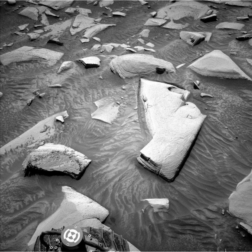
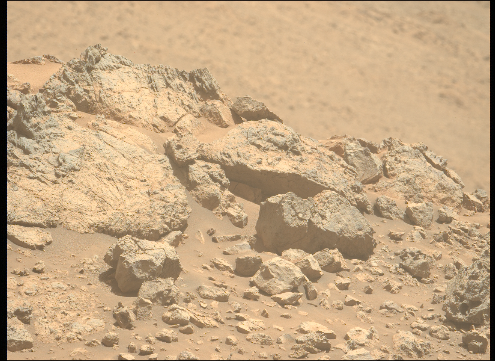
Today I served on science operations as the “keeper of the plan” for the geology and mineralogy theme group. In this role, I assembled the activities in our team planning software for this two-sol plan. Our small plan becomes part of a much larger set of instructions that will be relayed up to the rover later today. Currently, the Curiosity rover is driving up Mount Sharp over broken-up blocks of bedrock and sand through a small canyon en route to the boxwork structures ahead. This bumpy terrain can sometimes make it hard to pass the “Slip Risk Assessment Process” (SRAP) where all six wheels are required to be stable on the ground before we can unstow our robotic arm to use the contact science instruments. After our successful 8-meter drive (about 26 feet) from yestersol we passed SRAP and got to work selecting targets for contact and remote observations.
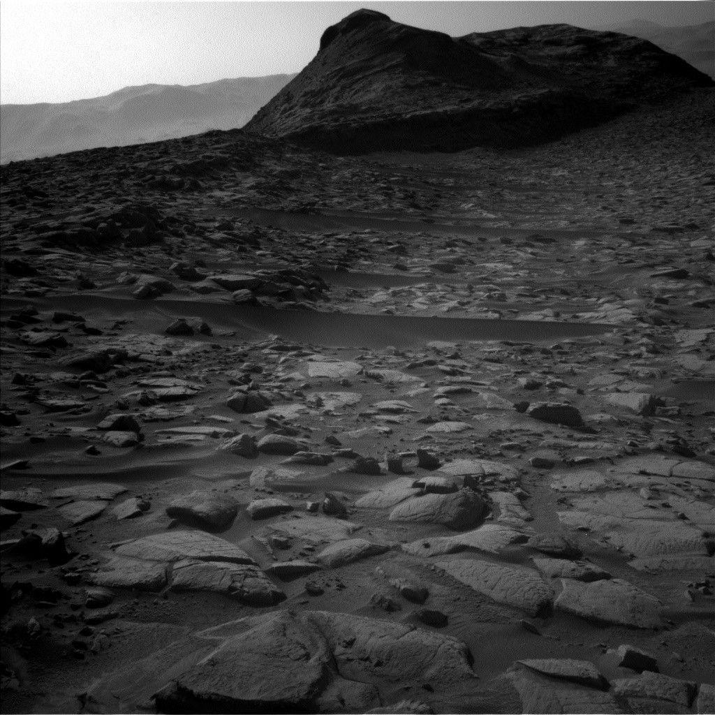
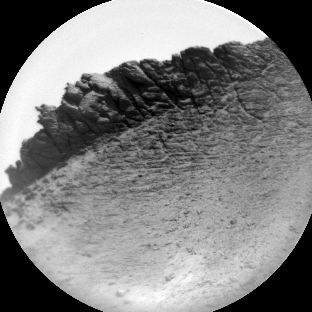
The team chose to characterize a bedrock target in front of us called “Chuckwalla” using the dust removal tool (DRT), APXS, and MAHLI. ChemCam used its LIBS instrument to analyze the chemistry of a nearby bedrock target with a knobby texture, “Pechacho,” and took a long distance RMI image to study the interesting layering in the “Devil’s Gate” butte. Mastcam assembled an impressive portfolio of observations in this two-sol plan. The team imaged variations in bedrock textures at “Jalama” and “Julian” and documented the nature of the “Mishe Mokwa” ridgeline. In addition, Mastcam imaged darker rocks within a previously acquired mosaic of Devil’s Gate and investigated narrow troughs (small depressions) within the sand in the workspace.
The environmental theme group, with their eye on the sky, included activities to measure the optical depth of the atmosphere, constrain aerosol scattering properties, and observe clouds. A very busy day of planning for sols 4500-4501, with many more to come!
Share
Details
Related Terms
Explore More


What's Your Reaction?